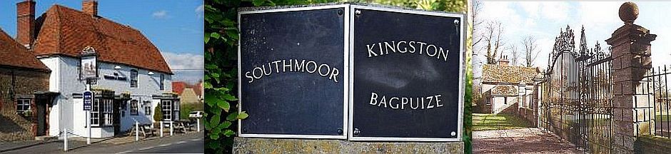
Expansion unites the villagesIn the 1960s, because of its position just outside the perimeter of Oxford's Green Belt, estates were built filling in many spaces in the village - Frax Close, Rimes Close, Draycott Wood, Norwood Avenue, Bellamy Close and Cherry Tree Close, and a range of infills along the Faringdon Road - more than doubling the population of the two villages. The village primary school moved into the new John Blandy School on the Draycott Estate in 1968 and 3 acres of original orchard land was bought as a recreational area beyond the school playground. Following the boundary changes in 1974 North Berkshire Rural District became the Vale of the White Horse District in the County of Oxfordshire. There had been a long history of rivalry between Southmoor (or Draycott Moor) and Kingston Bagpuize. Southmoor had had its chapel and absentee landlords since Saxon times (first Abingdon Abbey then St John's) whereas Kingston Bagpuize had the church, school and manor with resident aristocratic lords. The two parishes became the civil parish of "Kingston Bagpuize with Southmoor" in 1971 thus uniting east and west. As traffic through the village along the A420 trunk road was so heavy, the only building permitted after the early 70s and before a bypass was built was the Lime Grove development on the old paddock of Heath House. On Thursday 17th December 1992, the long promised bypass was opened, banishing the thundering lorries, car transporters and racing commuters, and helping to unite the village from north to south. The building of the bypass was followed immediately by another round of house building - Blenheim Way estate, the Paddocks and a number of individual houses along the Faringdon Road and Witney Road. These developments covered an asparagus field and a pig farm as well as garden infills. With the crisis in the market for English orchard fruits and the retirement of Gordon Maclean (owner), the Apple Centre on the Witney Road was redeveloped as residential land. It was the major removal of land from farming production, part of a national strategy (along with substantial 'set-aside'), on top of the need for more housing, which also contributed to this change of land use. The most recent development between the old Oxford Road and the Hind's Head completes the infill at the east end of the village. Discussions concerning a boundary change along the western edge of Southmoor have begun. The Boundaries Commission may seek to incorporate that part of Longworth parish south of the bypass into Kingston Bagpuize with Southmoor. Thus the alignments of roads and buildings, following the ridge of sandstone and limestone from Oxford to Faringdon, have had a strong impact on the development of these villages.?
Thanks for reading; please return to the homepage.
|